Sunday, August 8, 2010

Made It!

To view my Best Of Trip List click here

Tuesday 8-3. I MADE IT:)  Day 89 - 72 miles 4417 miles total. Salmonberry Park to Florence. The first leg of the day from Salmonberry Park to Waldport was very nice with rolling hills through rain forest on a quiet highway along the Alsea River. Had a wonderful breakfast dockside at Tidewater. At Waldport we got first sight of the Pacific and shortly after came the wheel dipping :) The ride down the coast on Pacific Coast Highway 101 was the most scenic of the trip. There were stunning views of the Oregon Coast and I stopped for many pictures. I also stopped at Haceta Head Lighthouse. This ride could be the best day of the trip except for the heavy traffic on PCH101. Victory dinner that evening was at International Seafood House in "Old Town" Florence, an eclectic area of restaurants, bars and gift shops on the Siuslaw River.


SUCCESS!

Group Success - all 14 of us.

Haceta Head Lighthouse - Oregon Coast


Oregon Coast


Oregon Coast


Victory Dinner

Oregon To The Coast

Monday 8-2 day 88 62 miles 4345 total. Coburg to Salmonberry Park. Crossed the coastal range with the last big climb of the trip 6 miles of up to 6% grade, but a very nice ride. We are now firmly on the coastal side of Oregon. Salmonberry is located near the town of Alsea on the Alsea River among large moss covered trees.


Hayden Bridge - 1918

But which way to the coast?

Sunday 8-1 day 87 - 57 miles 4283 total. McKenzie Bridge to Coburg. A splendid ride mostly downhill with nice scenery. McKenzie river was on the left most of the way. There was some fog in the morning that did not hinder riding. Cold morning, but cool and sunny in the afternoon. Saw two eagles and two Osprey today and got good pictures of the Osprey. 

Osprey in action

Covered bridge over the McKenzie River

Saturday 7-31 day 86 - 48 miles 4226 total. Sisters to McKenzie Bridge. Began the day with a 10 mile climb over McKenzie pass. This pass looked intimidating on the profile, but was pretty easy as passes go. Could it be by the end of the trip we're getting used to them? There was an observatory on the top of the pass that provided some spectacular view, especially of the lava flows. The day ended with a long (10 miles) downhill into the city of McKenzie Bridge through the lush tall treed Willamette National Forest. For all that are interested McKenzie Bridge, Pass and River are named after Donald McKenzie who is a cousin to the famous Canadian explorer Alexander McKenzie for whom the McKenzie river in Canada is named.
BetterBill with sisters 

Friday 7-30 day 85 - 37 miles 4178 total miles. Prineville to Sisters. Very short day, some climbing, but otherwise a flat fast ride. Camped at Evered's Ranch. Beautiful view of The Sisters and Mt. Jefferson with a pond to swim in. Patty Evered was an excellent host on a ranch with a view.

Patty Evered


Relaxing at camp

Nice Sunset

Barn with Three Sisters

First view of Three Sisters

Thursday 7-29 day 84 - 49 miles 4141 total miles. Mitchell to Prineville. The day began with a long 10 mile climb, but it was all downhill from there and a short day at that. Found great ice cream at Tastee Treat in Prineville. New beer of the trip was Mirror Pond Pale Ale from Deshutes  Brewing Co. of Bend, Oregon.

This one is pretty good! Quote of the day:
"You can only drink 30 or 40 glasses of beer a day no mater how rich you are." August Bush

Wednesday 7-28  day 83 - 86 miles - 4092 total. Prairie City to Mitchell. This was the longest ride of the trip and featured hills, rain, flat tire, and great scenery - all in all a wonderful day. Picture Gorge was beautiful and I got nice pictures of the fossil beds and overview. Stayed the night in the Historic Oregon Hotel. Very quaint, nice well kept and better than expected. The last big climb of the day topped out at ten miles from the hotel. The decent was so steep and long that I did not peddle one stroke from top to hotel and attained speeds of 48 mph without even tucking. Fantastic!


Overview of fossil beds area

Oregon barn scene

Tuesday 7-27 day 82 - 68 miles - 4006 total miles. Bakers City to Prairie City. Today was much different than the past two days in Hell's Canyon. The ride featured three mountain passes that were not too bad and a lush forest with lots of trees. The Oxbow Restaurant and Saloon in Prairie City was a big hit with everyone ( focus on saloon).

Prairie Scooner display near Prairie City, OR


Excellent restaurant and Brewpub in Baker City where they say
 "Beer: So much more than just a breakfast drink"!

Oregon Bicycle Rack

Monday, July 26, 2010

Eye Popping Idaho

Monday 7-26 day 81 Layover day in Baker City.

Sunday 7-25 day 80 - 54 miles 3938 total. Halfway to Bakers City. Another hot day in Hell's Canyon. Bike computers measure 110 degrees. This was not in the shade, but there was no shade. no water and lots of climbing. This was a tough day!

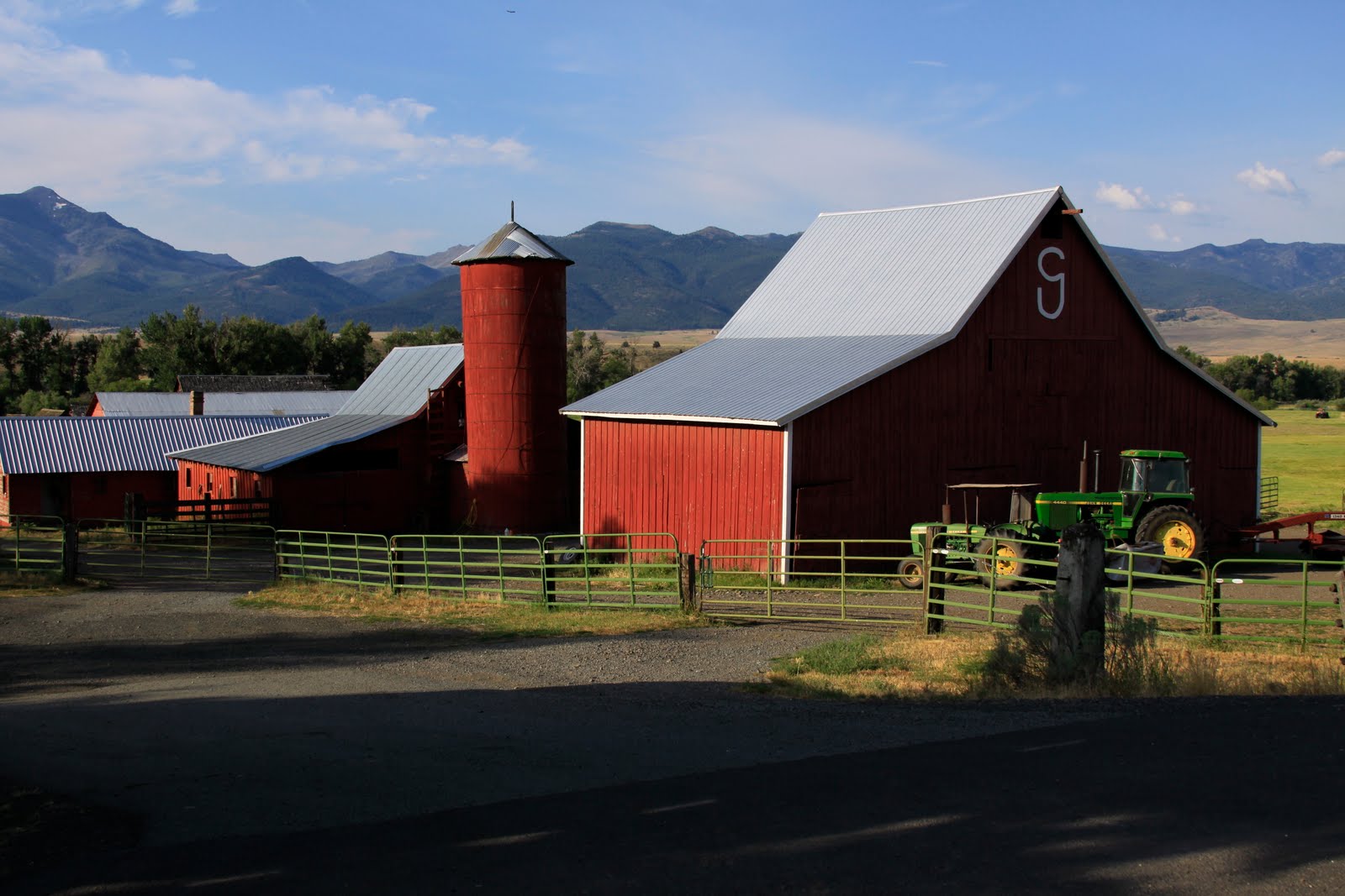
Nice photo of a barn, but this is not Hell's Canyon. There are no trees in Hell's Canyon.

Saturday 7-24 day 79 - 80 miles 3884 total. Council to Halfway Oregon. New state day today: OREGON the final state. As soon as we crossed the Snake River into Oregon the river was lined with Cherry trees limbs bowed with fat ripe cherries. There were also lots of Blackberry bushes, but those who picked them received flats from the thorns. Then we entered Hells Canyon. I'm sure it was named for the heat there - 103 at Scotties Station. Had a wonderful dinner that night at Mimi's Cafe in Halfway. I had a great Salmon Burger and shared a delicious bottle of Hell's Canyon Retriever Red wine with Ray and Michel. This might have been the best dinner of the trip, and in such an unexpected place.


Dinner at Mimi's Cafe with Joe, Will, James, Jack, Michel, Bill & Ray


Nice barn in Idaho

Jack at top of climb

Friday 7-23 day 78 - 62 miles 3804 total. Riggins to Council.  Another fine day on the bike with an easy climb in the morning, but a tougher climb to end the day. Followed the Little Salmon River most of the day. Camp was a nice RV park with maybe the best showers of the trip.

Thursday 7-22 day 77 - 53 miles 3742 total. Grangeville to Riggins. There was a tough climb up White Bird Hill to begin the day, but fun fast downhill with many switchbacks. Followed the Salmon river most of the way. Camped at a pretty campsite on the Salmon River in Riggins - the whitewater capitol of Idaho!


Sunset at Riggins camp with Salmon River in foreground.

Wednesday 7-21 day 76 - 50 miles 3689 total. Lowell to Grangeville. Today's ride was up the middle and south forks of the Clearwater River. Steep climb at the end of the day was not as bad as advertised. I had the best smoothie of the trip so far at Hanna's Closet and Espresso.

You may remember Randy and Meg who started the trip with us, but left us at Chester, IL. They are from Idaho and Meg found us here in Grangeville. She helped us shuttle groceries and had dinner with us. It was nice to see her again.

James and Mort at top of White Bird Hill

Clearwater River


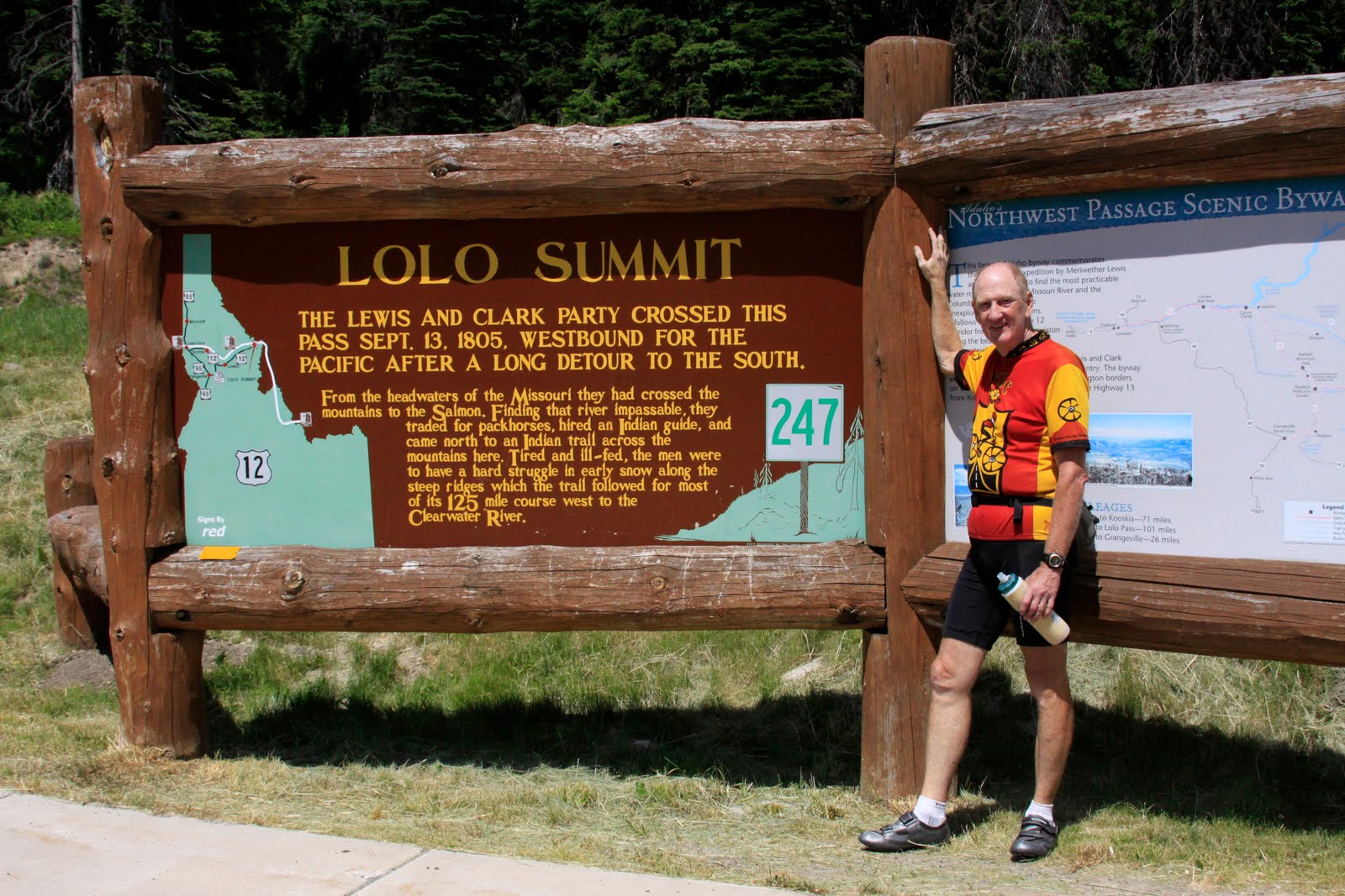
Tuesday 7-20 day 75 - 66 miles 3639 total. Lochsa Lodge to Lowell. Travel through the Selway and Bitterroot Wilderness and the Clearwater National Forest. Lots of history here. US Highway 12 from Lolo, MT, over Lolo Pass, to Lowell ID is the general path that Lewis & Clark took in 1804  on their Voyage Of Discovery. It is also the route that the Nes Perce Indians took on their failed attempt to flee the US Military in 1877. It was a very difficult trail at the time, but today it is a beautiful drive. Western Ceders reach to the clouds with Engleman Spruce, Lodgepole Pines and other pines joining in. The forest floor is covered with ferns and other growth. To the left is the everpresent Lochsa River with many streams and waterfalls flowing in from the right. The ride through it was 65 miles downhill with cool temperatures. It was truely one of the best days of the trip. This is a pretty and historic highway with little traffic. You should plan to drive (or bike) it someday.

Tumble Down waterfall.

Waterfall

Lochsa River

Robert, Jack, Olaf and Mort viewing Lewis and Clark Information

Monday 7-19 day 74 - 57 miles 3573 total. Missoula to Lochsa Lodge, Idaho. Traveled the Lolo Trail over Lolo Pass (5225') into Idaho. Idaho turns into a lush dense forested area wilderness. In addition to a new state day we also passed into Pacific time. Even with the Lolo Pass climb, it was a very enjoyable ride. Rod, Ginny, and Gregg from Adventure Cycling Association came down to Lochsa Lodge and put on a BBQ for us that evening.

ACA barbeque

Rod and helpers from ACA 

BetterBill at summit of Lolo Pass


Olaf and Robert at ACA headquarters in Missoula, MT

Sunday, July 18, 2010

Made it to Missoula

Sunday 7-18 day 73. Layover day in Missoula.

Saturday 7-17 day 72 - 74 miles 3516 total miles. Darby to Missoula - home of Adventure Cycling Association. A long uneventful day except for my third flat, but a very enjoyable downhill ride. Staying at Hutchins Hostel. A very nice hostel.

Bitterroot Mountains with shadow

Cranes in Field
Friday 7-16 day 73 0 77 miles 3442 total miles. Jackson to Darby. Climbed over Chief Joseph Pass (7241') this is the last crossing of the Continental Divide. We have been crisscrossing it since Hoosier Pass in Colorado. From now on we will be peeing into the Pacific. Visited Big Hole Battlefield National Monument Visitors Center and watched a video about treatment of the Nez Perce Indians. The days are getting warmer (90 degrees) but the nights are still chilly.


Beaverhead Rock a Lewis & Clark Landmark
Camp at Dillon KOA with Beaverhead River
Thursday 7-15 day 72 - 49 miles, 3365 total. Dillon to Jackson. Climbed over Badger Pass (6760') descended some then climbed Big Hole Pass (7360'). Big Hole Pass just kept getting steeper and longer. It almost brought me to tears before I topped it. It was tougher than I expected and I'm glad it was a short day. Two big passes just whipped everyone. Misquotes are becoming a real problem. Stayed at Jackson Hot Springs Lodge. The Hot Spring was very hot and sooo relaxing.

Breakfast at Virginia City

Ray practicing his post tour activities
Wednesday 7-14 day 71 - 73 miles, 3316 total miles. Ennis to Dillon. The day began with a long 8 mile 7% climb up the Madison River Valley followed by a long cold downhill. Interesting thing of the day was a cattle drive up the pass on the highway. Nice camp that evening at the Dillon KOA beside the Beaverhead River.

Ray and Michel chugging up Madison River Valley Pass

View of Madison River Valley

Montana Cattle Drive

Tuesday 7-13 day 70 - 73 miles 3243 total miles. West Yellowstone to Innis. Took no pictures today. Montana is Big Sky country, but not very photogenic. The most notable thing of the day was my second flat and hopefully my last - nope!